
Look at a map of the Atlantic and a question almost asks itself: could the eastern edge of South America once have sat beside the western edge of Africa? For centuries, that resemblance invited speculation. In the early twentieth century, Alfred Wegener gave the question new force. He gathered clues from rocks, fossils, ancient climates, and coastlines, and proposed that continents now separated by oceans had once belonged to a larger whole. The idea was incomplete, and its proposed engine would not hold up. Yet the evidence he assembled helped change how people imagined Earth: not as a finished map, but as a planet still in motion.
Wegener was born in Berlin in 1880. Trained in astronomy and drawn to meteorology, he became known for his work in atmospheric physics and for repeated expeditions to Greenland. He was not the first to suggest that continents had moved. What distinguished his proposal was the breadth of evidence he tried to make it explain. Instead of treating the fit of the continents as an isolated curiosity, he asked whether the geology on either side of the Atlantic, the fossils beneath distant landscapes, and the traces of ancient climates might all belong to one history.
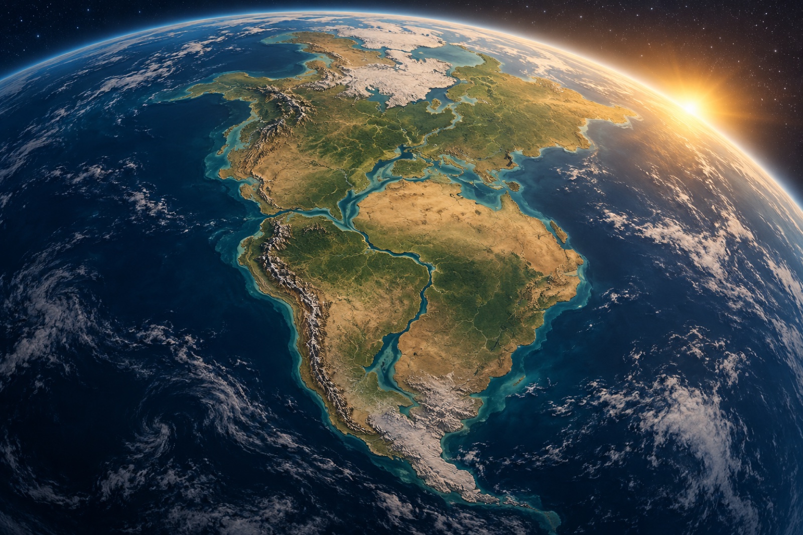
In 1912, Wegener presented his continental-drift hypothesis. Three years later he developed it in The Origin of Continents and Oceans, revising the book as new observations and criticism came his way. A clear fit between South America and Africa was a memorable beginning, but coastlines change through erosion and shifting sea levels. Wegener and later researchers found a more telling match by comparing the continental shelves and the geological structures beneath them. The outlines were not a perfect jigsaw; they were pieces of a larger story.
Fossils offered another striking clue. The seed fern Glossopteris appears in rocks across South America, Africa, India, Antarctica, and Australia. Fossils of Mesosaurus, a freshwater reptile, are found in southern Africa and South America. Such distributions are difficult to explain by crossing wide, saltwater oceans. They make more sense if the lands were once joined or close together. Likewise, rock layers and mountain belts on opposite sides of the Atlantic show similarities that become easier to understand when the continents are reconstructed together.
The climate record added a different kind of evidence. Glacial deposits and scratches in rocks occur across parts of the southern continents that are now far from the poles. At the same time, coal formed from abundant plant life appears in regions that are cold today, including Antarctica. These patterns do not mean that every ancient climate can be read from one clue. They do show that the continents have occupied different latitudes and climates over deep time. Put fossils, rocks, and climate indicators on the same map, and the scattered marks begin to connect.
Wegener called the ancient assembly Pangaea in later editions of his work. He pictured it breaking apart as the continents slowly moved toward their present positions. But he could not provide a convincing physical mechanism. He suggested forces connected with Earth's rotation and the tides, and imagined continents pushing through denser oceanic crust. Geophysicists showed that these forces were far too weak to do what he proposed. This was not a small gap. A powerful pattern of evidence had met a serious unanswered question about how a solid planet could move.
For that reason, the history is not simply a tale of a lone visionary ignored by a stubborn establishment. Many scientists saw problems in Wegener's mechanism, and they were right to take those problems seriously. At the same time, some critics treated the missing mechanism as if it erased the evidence itself. The better lesson is harder and more useful: observations can point toward an important idea before scientists understand the processes that make it possible. A strong hypothesis must be tested from every side, but it can also help reveal what the next generation of measurements needs to discover.
For decades after Wegener's death, new tools began to make the ocean floor less mysterious. Sonar mapping revealed long mountain chains and deep trenches beneath the waves. Researchers discovered that oceanic crust is geologically young compared with much of the continents. Measurements of magnetic minerals recorded repeated reversals of Earth's magnetic field, and matching bands on either side of mid-ocean ridges pointed to new seafloor forming and moving outward. Earthquake and volcano patterns traced the boundaries of large moving plates.
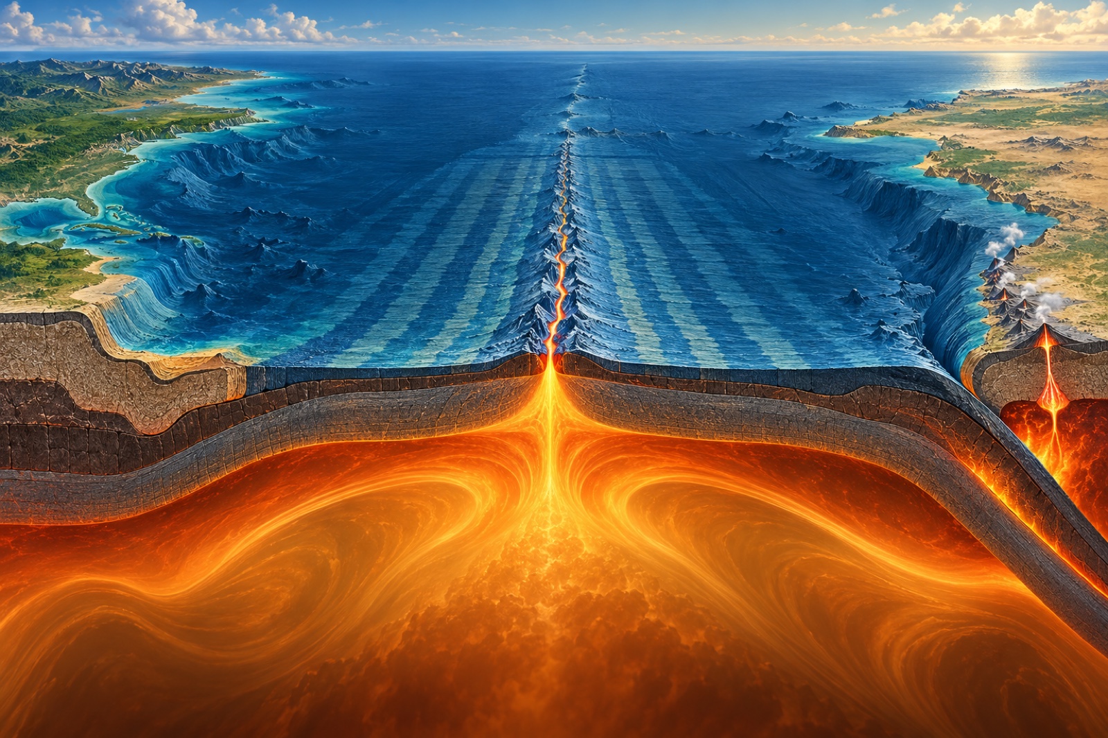
In the 1960s, these discoveries came together in the theory of plate tectonics. The ocean floor was not an immovable surface that continents had to plow through. Continents travel as parts of larger lithospheric plates. New oceanic crust forms at spreading ridges, while older crust can descend beneath other plates at subduction zones. Magnetic stripes preserve a record of this spreading. Plate movement has several contributing forces, including the pull of sinking slabs and the push of elevated ridges, with mantle flow also playing a role. The details remain an active area of research, but the broad framework explains earthquakes, volcanoes, mountain building, and changing ocean basins in a coherent way.
In this new framework, Wegener’s central observation found a home, while the mechanism he proposed was set aside. Plate tectonics did not prove every line of his original argument, nor did it arrive because the old proposal had been waiting unchanged for acceptance. It grew from a much larger body of evidence and from decades of work by scientists across disciplines. Its power comes from connecting processes that once seemed separate: the birth of ocean floor, the rise of mountain ranges, the tremor of earthquakes, and the slow rearrangement of continents.
That way of working is part of Wegener’s lasting contribution. He looked across the borders of scientific fields and asked them to inform one another. Paleontology could help test a map; geology could give fossils a wider setting; climate evidence could reveal the movement of land through time. Today, researchers use seismic measurements, satellite positioning, ocean-floor mapping, and computer models to refine the same planetary picture. The methods have changed dramatically. The curiosity that asks how separate observations might fit together still carries the work forward.
There is inspiration in that long arc, but it is not the easy inspiration of a genius who was simply right all along. Wegener was bold enough to organize evidence into a new picture, and the scientific community was right to press him for a mechanism. The next steps required more people, better instruments, and ideas that went beyond his own. Progress emerged through that continuing exchange: a proposal that made room for new questions, criticism that sharpened the search, and observations that eventually opened a path to a stronger theory.
Earth’s surface feels permanent beneath our feet, yet its continents are always traveling - so slowly that a human lifetime can scarcely notice. Look again at the map: familiar coastlines, mountain chains, and fossil beds are not disconnected features, but traces of a planet with a long and unfinished story. Wegener helped make that story visible. For anyone working at the edge of what is known, his example offers a patient kind of courage: follow the evidence where it leads, welcome the tests that challenge an idea, and leave the next generation a question worth answering.